Toppen
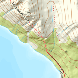
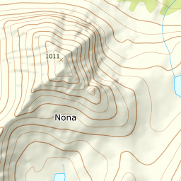
721 metres of ascent over 2.64 km from Toppentunnelen to Toppen — 758.6 on screen against the published 759, and Grytøya's seventh tour in the app: the island that began with Nona is now complete from Dale to Skjellesvika. The east side of Hallevikelva, south of Toppskarvatnet on dry land, and the ridge south. KAST 3 – Complex with ice axe and crampons; the route crosses avalanche terrain. Grade 4.
Elevation profile
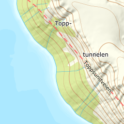
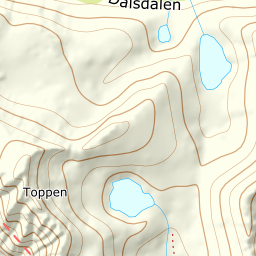
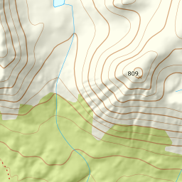
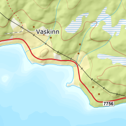
721 metres of ascent over 2.64 km from Toppentunnelen: the east side of Hallevikelva, south of Toppskarvatnet at 516 — and the ridge south from 611 to the cairn at 759.
From the lay-by on the fv. 7756 Toppsundveien just before Toppentunnelen — 40 m; the source's F15 is today's county road, the archive's fourth road-renumbering note — the line climbs the east side of Hallevikelva: the treeline already at 278 after 0.68 km, and the steepest single step, 29.2 degrees between 154 and 179 m, sits in the first slope.
Route description, descent and avalanche terrain open with a subscription — 14 days free, then 29 kr/month.
Start free trialMore tours in Harstad
- Hattfjellet857 m · Demanding
- Stortussen945 m · Demanding
- Litletussen795 m · Demanding
- Slåttheia694 m · Moderate
- Skjellesvikgalten987 m · Expert
- Nona1009 m · Expert
- Trolltinden918 m · Demanding
- Årbostadtinden1179 m · Expert
- Klåptinden998 m · Demanding
- Lundenesgalten787 m · Demanding
- Middagstinden på Andørja630 m · Moderate
- Skartinden1149 m · Expert
- Langlitinden1276 m · Expert
- Kråkrøtinden1186 m · Expert
- Ristinden1056 m · Expert
- Snøtinden1215 m · Expert
- Storhornet i Kvæfjord722 m · Easy
- Vetefjellet547 m · Moderate
- Storlitinden613 m · Easy
- Stortinden på Rolla1020 m · Expert
- Rundtinden872 m · Demanding
- Sula848 m · Moderate
- Heia527 m · Easy
- Hinnstein560 m · Demanding
- Lasselitinden896 m · Demanding
- Hemmestadfjellet686 m · Moderate
- Middagstinden i Kvæfjord922 m · Expert
- Nattmålsfjellet546 m · Demanding
- Horntindan911 m · Expert
- Tverrfjellet889 m · Moderate
- Sørvikfjellet607 m · Expert
- Melåaksla916 m · Moderate
- Rundfjellet i Harstad868 m · Moderate
- Jakobstinden976 m · Demanding
- Haukebøtinden905 m · Moderate
- Reinspælen1117 m · Expert
- Sætertinden1095 m · Moderate
- Kongsviktinden980 m · Demanding
- Snøtinden i Tjeldsund980 m · Moderate
- Taraldsviktinden776 m · Demanding
- Nonstinden930 m · Expert
- Snøtindan996 m · Expert
- Fiskefjordtindan965 m · Demanding
- Middagsfjellet810 m · Demanding
- Strandtinden1076 m · Demanding
- Jotind979 m · Expert
- Siriskolten659 m · Easy
- Trollfjellet1009 m · Moderate
- Helligtinden948 m · Demanding